Port St. Lucie radar
Live Doppler radar for Port St. Lucie, Fort Pierce, and the rest of St. Lucie County. Below the map is the part a national radar site cannot tell you: what the picture usually means here, and when our storms tend to fire.
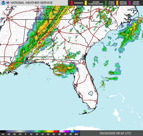
What the map is showing you
Radar tells you where precipitation is right now and which way it is moving. It is a picture of the present, not a forecast. Heavier rain returns a stronger signal and shows as more intense colour on whatever scale the map is using, so read the legend before you read the storm.
The single most useful habit is to watch the loop rather than the still. One frame tells you where the rain is; several frames tell you whether it is coming toward you, falling apart, or turning. On a Treasure Coast afternoon the difference between those three is most of what you actually want to know.
Radar also has blind spots. It sees precipitation, not cloud, so a grey sky can read as an empty map. It cannot tell you whether a storm carries lightning, and on the Treasure Coast lightning is the hazard that arrives first and travels furthest from the rain.
The shape of a storm day here
Most warm-season days on the Treasure Coast follow the same arc, and once you know it the radar stops being a surprise.
Mornings are usually the quiet part. Winds are light and variable and the map is often empty. Through the late morning an onshore east to southeast breeze builds, and cumulus start to grow with it.
By early afternoon the sea breeze is at full strength and its leading edge, the sea breeze front, has pushed inland past I-95. That front is the trigger. Through the late afternoon, storms fire along it and ahead of it, which is why the line you see on radar so often forms well inland rather than over the water. It is also why the beach can sit in sunshine while heavy rain falls over western Port St. Lucie. As the sun drops, the heating that drove the whole thing fades and the storms come apart.
Which side of the county gets it depends on the larger wind pattern that day. When the prevailing wind is from the east, the sea breeze is reinforced and the collision zone is pushed further west, away from us. When it is from the west, that zone shifts back east toward the Treasure Coast, and the storms are heavier closer to the coast. The full mechanism, hour by hour, is in our explainer on the sea breeze.
When to stop watching radar and act
Radar is for deciding whether to move the cookout indoors. It is not the tool for decisions that affect life or property. Warnings come from the National Weather Service, and evacuation orders come from St. Lucie County Emergency Management, based on each specific storm rather than on anything you can read off a map.
For active watches and warnings in St. Lucie County, use our alerts page, which pulls live from the National Weather Service. In hurricane season, start with the preparedness guide and follow the orders the county issues for your zone.
More local weather
- Understanding the sea breeze, the daily cycle that drives our afternoon storms.
- Marine weather for boating and fishing conditions on the water.
- The Treasure Coast climate guide, for what a normal month actually looks like here.
- Active weather alerts for St. Lucie County.