Not every flooded street on the coast comes with a storm. A tide that runs higher than usual can back water up through storm drains and over low ground on a calm, sunny day. People call the biggest of these tides king tides, and the National Weather Service has three alerts for the flooding they can bring.
St. Lucie County has both kinds of shoreline that tides reach: the ocean beaches, and the Indian River Lagoon behind them, which the ocean feeds through the Fort Pierce Inlet. This page covers what a king tide is, how high a tide has to run before it counts as flooding, what each coastal flood alert means, and what to do when the water is on the road.
What a king tide is
“A popular, non-scientific term people often use to describe exceptionally high tides.” (NOAA National Ocean Service)
NOAA describes tides as long, slow waves that roll around the planet as the moon and the sun pull the ocean back and forth. The pull is strongest at certain points in their orbits, so NOAA says higher than normal tides typically come during a new or full moon, when the moon is at perigee (its closest to Earth), or during particular seasons that differ around the country.
The EPA puts it more simply: the king tide is the highest regular high tide of the year at a place, and it comes once or twice a year. Either way, it is a forecastable event. NOAA predicts the tides every day, so a king tide is never a surprise to the tide tables.
Why king tides can flood a street on a sunny day
NOAA calls this high tide flooding. You may also hear it called sunny day or nuisance flooding. As sea level rises, NOAA says, it no longer takes a strong storm or a hurricane to flood the coast. A shift in the prevailing wind, a change in ocean currents, or the strong tidal pull around a full or new moon can each push the water above the normal high tide mark and onto streets.
It is happening more often. NOAA reports that high tide flooding is now twice as frequent in U.S. coastal communities as it was 20 years ago. The EPA makes the same point from the other direction: the water level a king tide reaches today is where an ordinary high tide will reach in the future, which is why photographs of king tide flooding are used to spot the places likely to flood in the future.
How high is high: NOAA's three levels
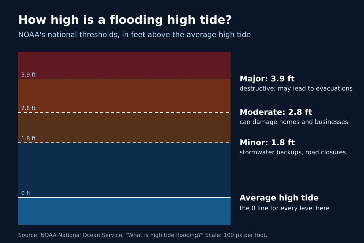
NOAA measures high tide flooding by how far the water rises above the average high tide at that spot, and sorts it into three levels:
- Minor: 1.8 feet above average high tide. Mostly disruptive: stormwater backs up and roads close.
- Moderate: 2.8 feet. More disruption, and it can damage homes and businesses.
- Major: 3.9 feet. Destructive. It may lead to evacuations and often means repairs to roads, utilities and property.
These are national thresholds that NOAA uses to compare coastlines. NOAA notes that its figures may differ from the National Weather Service's, because the Weather Service takes local flood risk into account when it decides whether to issue a coastal flood alert. For St. Lucie County, those alerts come from the NWS office in Melbourne.
Coastal flood alerts: advisory, watch and warning
The National Weather Service defines its three coastal flood alerts this way:
- Coastal Flood Advisory: minor or nuisance coastal flooding is occurring or imminent.
- Coastal Flood Watch: moderate to major coastal flooding is possible, flooding that would potentially pose a serious risk to life and property.
- Coastal Flood Warning: moderate to major coastal flooding is occurring or imminent, and it will pose a serious risk to life and property.
Coastal flood alerts for the county appear on our St. Lucie County alerts page, which reads the National Weather Service feed and refreshes every five minutes. For how they sit alongside the rest, see weather alert types explained and how to read an NWS alert.
When the water is on the road
The National Weather Service's advice for any flooded road is the same: Turn Around Don't Drown. It cites the Centers for Disease Control and Prevention: more than half of all flood-related drownings happen when a vehicle is driven into hazardous flood water. The Weather Service says 12 inches of rushing water can carry away most cars, and the road itself may have collapsed under water you cannot see through. Never drive around barriers blocking a flooded road.
Because this kind of flooding rides on the tide, NOAA’s tide predictions for high tide are the place to look for when the water is likely to peak. NOAA adds that the exact timing depends on the weather on the day.
How to know when king tides are coming
NOAA publishes a Monthly High Tide Flooding Outlook that shows, up to a year ahead, the daily likelihood that a higher than normal high tide may lead to at least minor flooding at its water level stations. NOAA is clear about its limits: weather can still cause flooding on days the outlook does not flag, and within five days of a date you should go by the National Weather Service forecast.
For the sea itself, see our marine weather page, and our guide to rip currents if you are headed to the beach.
Frequently asked questions about king tides
Sources
- NOAA National Ocean Service, What is a King Tide?
- NOAA National Ocean Service, What is high tide flooding?
- NOAA Tides and Currents, Monthly High Tide Flooding Outlook.
- U.S. Environmental Protection Agency, King Tides and Climate Change.
- National Weather Service, Watch/Warning/Advisory Definitions.
- National Weather Service, Turn Around Don’t Drown.
Before you drive the low road
Check whether a coastal flood alert is up on our live alerts page, watch rain and storms on the radar, or open the command center for everything at once.